Industries

We help energy and engineering companies automate infrastructure planning and routing by saving time, money and CO₂ with better data, visuals and communication.

Our Pathfinder Platform can be used in types of linear infrastructure projects to optimize routing of cable, oil and gas, pipe, powerlines, renewables, roads, telecom, transport and water as well as by energy agencies and governmental bodies.

Learn more about how we work with different industries.

wind engineering

Engineering & Renewables

power station

Power Utilities

rail engineering

Transportation

Get the results you need

Leadership & finance, project management
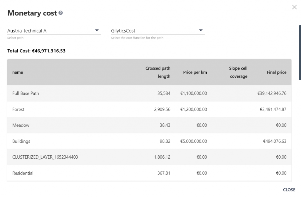
  • Simplify and automate complex, slow, inefficient manual infrastructure planning processes
  • Improve precision in cost projections and budget management
  • Streamline coordination and approvals at different project stages
Finance and cost report

Engineering

  • Automate optimal routing or site selection and reduce planning times
  • Easily manage multiple technical parameters and regulatory complexities

With Pathfinder’s rapid scenario generation and analytical capabilities, engineers can swiftly compare alternatives, gaining comprehensive insights that cut down on months of evaluation into seconds and minutes.
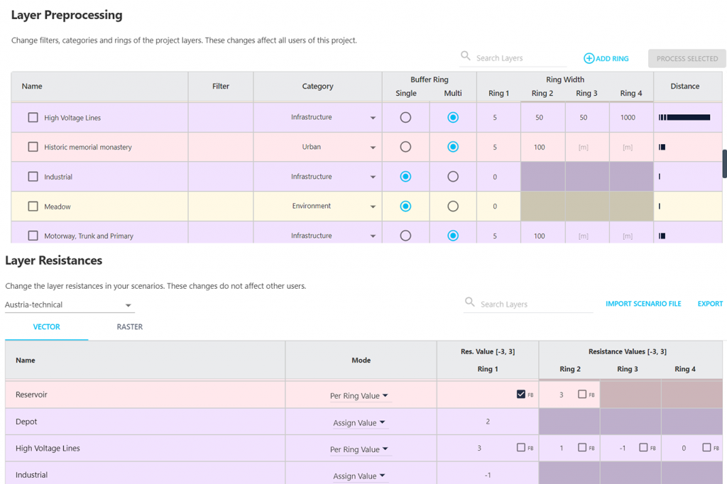
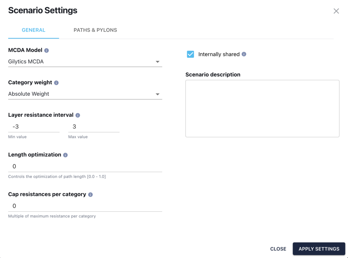
Engineering, Pathfinder settings
Pathfinder scenario settings

GIS data analyst

  • Easily set up planning rules and compliance
  • Speed up the creation of scenarios and alternatives for comparison
  • Add your own data & selected databases to gain data-driven insights
  • Add data from Gilytics geodatabase

Our GIS layer classification and interactive tools bridge the data utilization gap, fostering strategic decision-making without the need for additional software
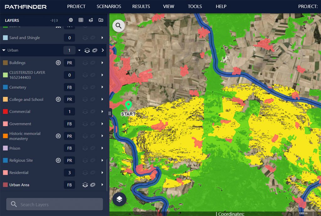
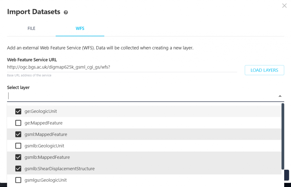
Working with geo data
Pathfinder data import

Environmental management

  • Easy modelling of regulatory compliance and planning rules
  • Help planning teams meet project timelines and enhanced performance
  • Simplify complex environmental assessments of proposed sites and linear alternatives

Leverage Pathfinder powerful geospatial data analysis tools to streamline the evaluation of environmental factors, enabling a more efficient and accurate assessment process
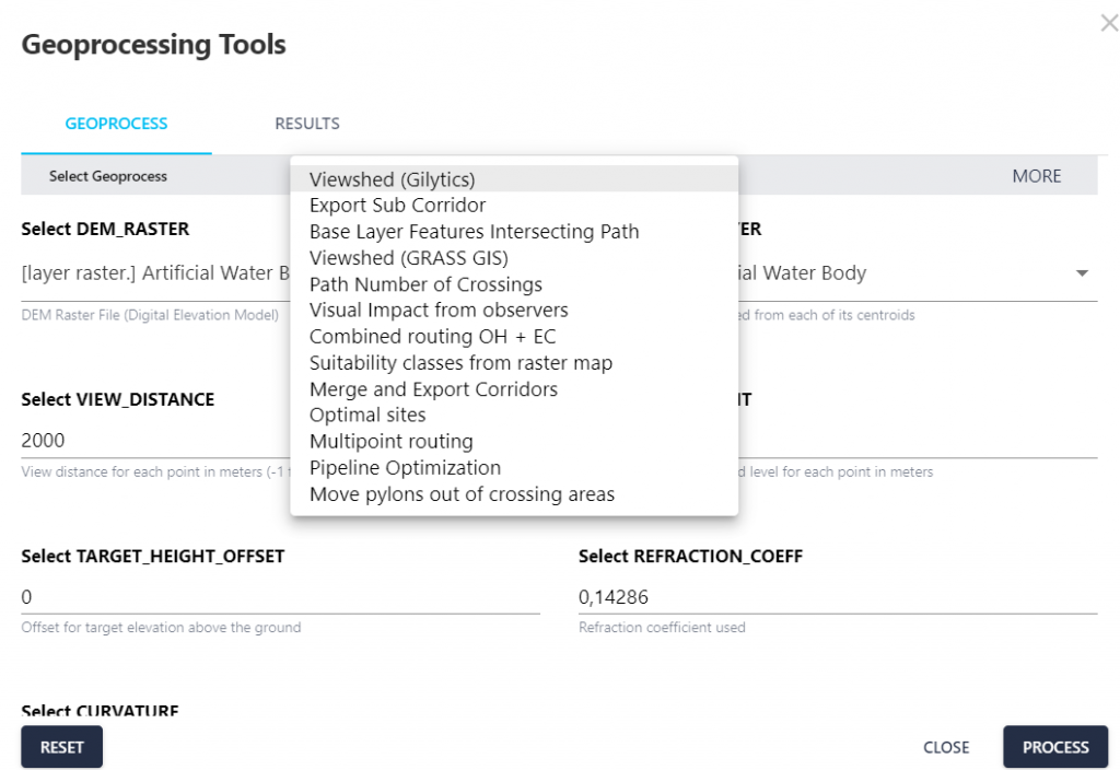
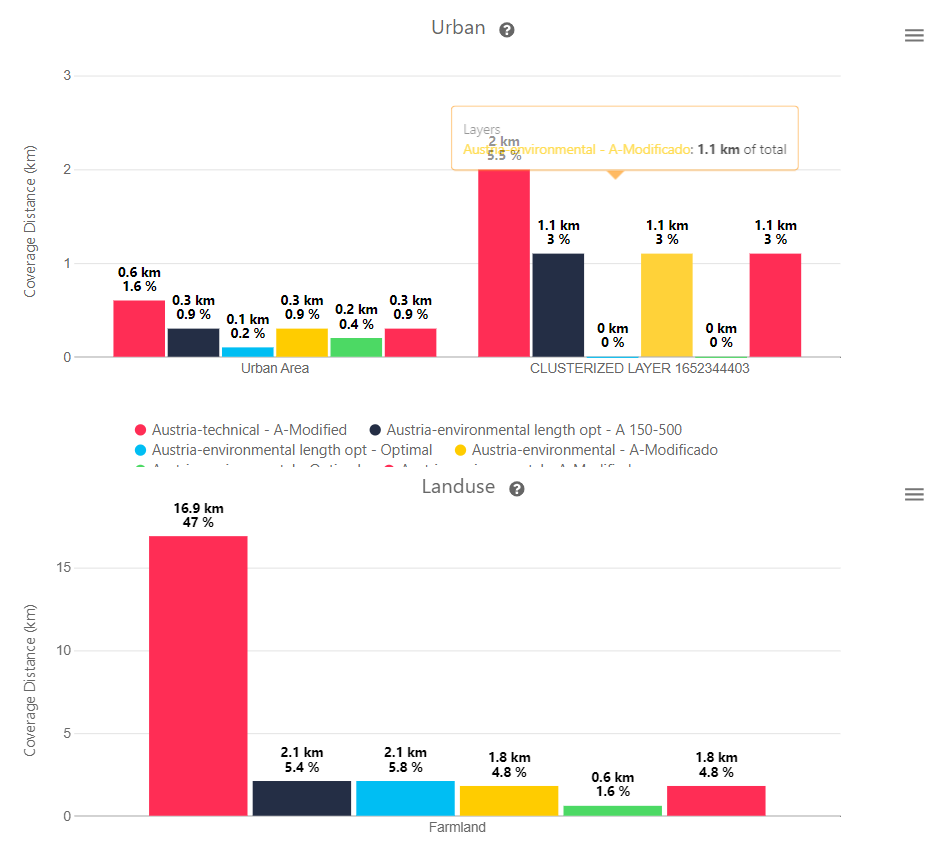
Geoprocesses for environmental analysis
Data analytics and reporting

Stakeholder engagement & communication

  • Increase transparency & communication with stakeholders
  • Improve public understanding with 3D visualizations without a need for technical skills
  • Share quantified results to explain alternatives and avoid subjectivity

Overcome the traditional challenges of infrastructure project communication, fostering a transparent, engaged, and
cooperative project environment.
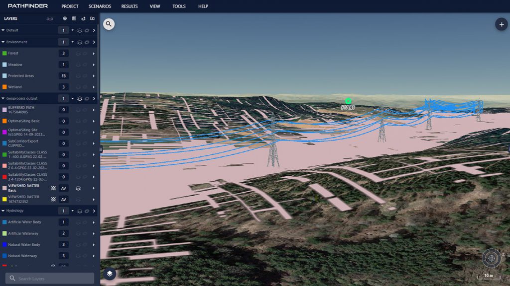
3d visualization
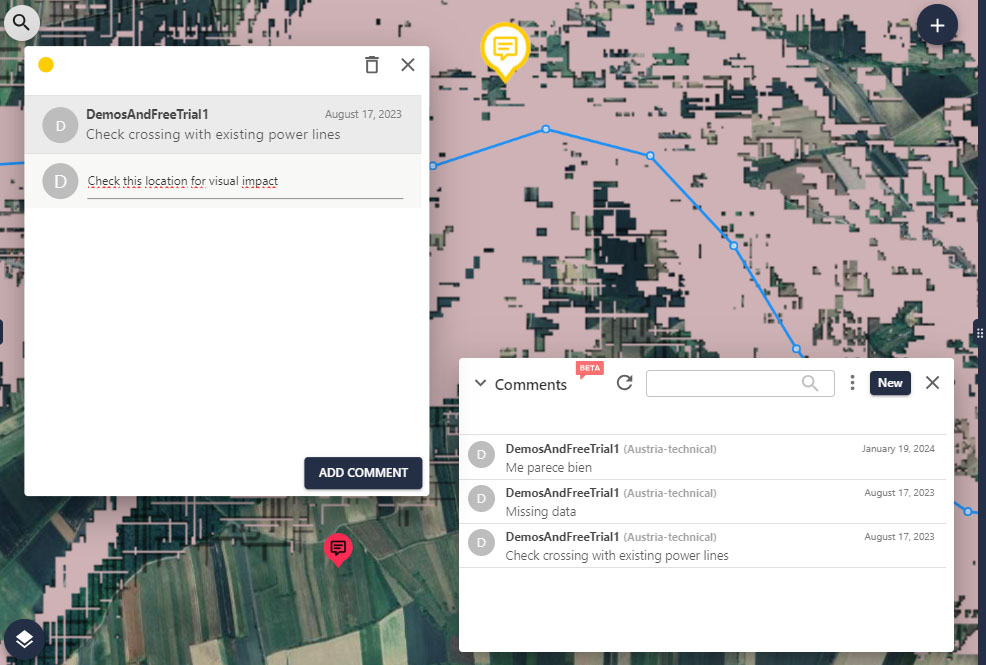
Collaboration tools and commenting system

Trusted by our clients

swissgird logo
DB logo
Tennet logo
elia group logo
SBB CFF FFS
Axpo logo
ATCO logo
As plus umwelt energie logo
ESB logo
Fingrid logo
Fichtner logo
OGE logo
groupe E logo
HwaShinPowerTechL black
Amprion
Arcadis logo